
Concan topographic map
Click on the map to display elevation.
About this map
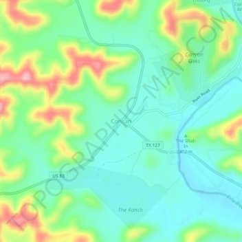
Name: Concan topographic map, elevation, terrain.
Location: Concan, Uvalde County, Texas, 78838, United States (29.48044 -99.74263 29.52044 -99.70263)
Average elevation: 419 m
Minimum elevation: 369 m
Maximum elevation: 530 m
Other topographic maps
Click on a map to view its topography, its elevation and its terrain.