
La Scheulte topographic map
Interactive map
Click on the map to display elevation.
About this map
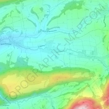
Name: La Scheulte topographic map, elevation, terrain.
Location: La Scheulte, Val Terbi, District de Delémont, Jura, 2824, Suisse (47.33865 7.44733 47.35057 7.50745)
Average elevation: 604 m
Minimum elevation: 484 m
Maximum elevation: 951 m
Other topographic maps
Click on a map to view its topography, its elevation and its terrain.