
Thank you for supporting this site ❤️
Make a donation
Make a donation
Confederate topographic map
Click on the map to display elevation.
Thank you for supporting this site ❤️
Make a donation
Make a donation
About this map
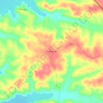
Name: Confederate topographic map, elevation, terrain.
Location: Confederate, Lyon County, Kentucky, United States (36.97200 -88.01752 37.01200 -87.97752)
Average elevation: 143 m
Minimum elevation: 103 m
Maximum elevation: 181 m
Thank you for supporting this site ❤️
Make a donation
Make a donation
Other topographic maps
Click on a map to view its topography, its elevation and its terrain.