
Thank you for supporting this site ❤️
Make a donation
Make a donation
Eddyville topographic map
Click on the map to display elevation.
Thank you for supporting this site ❤️
Make a donation
Make a donation
About this map
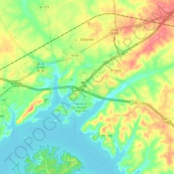
Name: Eddyville topographic map, elevation, terrain.
Location: Eddyville, Lyon County, Kentucky, United States (37.03577 -88.11936 37.10878 -88.01790)
Average elevation: 138 m
Minimum elevation: 106 m
Maximum elevation: 185 m
Thank you for supporting this site ❤️
Make a donation
Make a donation
Other topographic maps
Click on a map to view its topography, its elevation and its terrain.