
Make a donation
Marang topographic map
Click on the map to display elevation.
Make a donation
Marang
Marang has an area of 666 km². The district's topography consists of the South China Sea coast, peat swamps, hills and plains. The sub-districts (Malay: mukim) of Rusila, Pulau Kerengga and Merchang lie on the coast with sandy plains gradually giving way to hills in the interior. The Jerong sub-district is mainly hilly, while the sub-districts of Bukit Payong and Alor Limbat consist of rolling plains and peat swamps. The district's population of 84,938 (2000 census) is 97.2% rural and predominantly Malays (97.2%) while the Chinese are the biggest ethnic minority (2.6%). Most people in Marang use the Marang sub-dialect of Terengganu Malay.
Make a donation
About this map
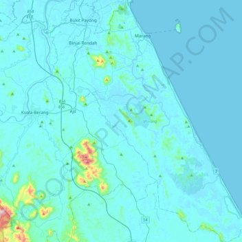
Name: Marang topographic map, elevation, terrain.
Location: Marang, Terengganu, Malaysia (4.85023 103.04367 5.26770 103.38749)
Average elevation: 30 m
Minimum elevation: -5 m
Maximum elevation: 626 m
Make a donation
Other topographic maps
Click on a map to view its topography, its elevation and its terrain.
Kuala Terengganu
Malaysia > Terengganu > Kuala Terengganu
As a part of Terengganu, Kuala Terengganu has a tropical rainforest climate under the Köppen climate classification (Af) with constant temperature and high humidity. The amount of rainfall varies according to the monsoon season. It is generally fairly hot and humid all year round, averaging from 28 °C to 30…
Average elevation: 9 m
Kampung Bukit Kecil
Malaysia > Terengganu > Kuala Terengganu > Kuala Terengganu
Average elevation: 9 m
Make a donation
Make a donation
Make a donation
Make a donation
Make a donation
Make a donation
Make a donation
Gunung Lawit
Mount Lawit (Malay: Gunung Lawit) is a mountain in Terengganu, Malaysia and has an elevation of 1,519 metres, which makes it the highest mountain in the state. Mount Lawit is situated northeast of Gunong Batil, and northwest of Sungai Susu Dara. Both locations are located in Besut District.
Average elevation: 1,146 m
Make a donation
Make a donation
Duyung Small Island
Malaysia > Terengganu > Kuala Terengganu > Kuala Terengganu
Average elevation: 4 m
Make a donation
Make a donation
Bukit Pelanduk
Malaysia > Terengganu > Kemaman District > Kampung Teluk Kalong
Average elevation: 19 m
Make a donation
Make a donation
Make a donation
Make a donation
Make a donation
Make a donation
Pak Mat Lebai Island
Malaysia > Terengganu > Kuala Terengganu > Kuala Terengganu
Average elevation: 6 m
Make a donation
Make a donation
Make a donation
Make a donation
Make a donation
Make a donation
Make a donation
Make a donation