
Thank you for supporting this site ❤️
Make a donation
Make a donation
Cerang Nibung topographic map
Click on the map to display elevation.
Thank you for supporting this site ❤️
Make a donation
Make a donation
About this map
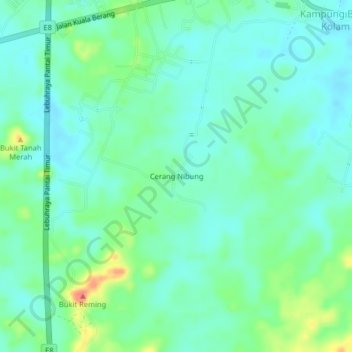
Name: Cerang Nibung topographic map, elevation, terrain.
Location: Cerang Nibung, Ajil, Terengganu, 21800, Malaysia (5.03828 103.05775 5.07828 103.09775)
Average elevation: 23 m
Minimum elevation: 7 m
Maximum elevation: 68 m
Thank you for supporting this site ❤️
Make a donation
Make a donation