
La Villette topographic map
Interactive map
Click on the map to display elevation.
About this map
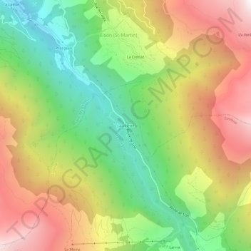
Name: La Villette topographic map, elevation, terrain.
Location: La Villette, Evolène, Hérens, Valais, 1983, Suisse (46.11994 7.44789 46.15994 7.48789)
Average elevation: 1,737 m
Minimum elevation: 970 m
Maximum elevation: 2,632 m
Other topographic maps
Click on a map to view its topography, its elevation and its terrain.
Ferpècle (Le Salay)
Suisse > Valais > Hérens > Evolène
Ferpècle (Le Salay), Evolène, Hérens, Valais, 1983, Suisse
Average elevation: 2,321 m