
Satarma topographic map
Interactive map
Click on the map to display elevation.
About this map
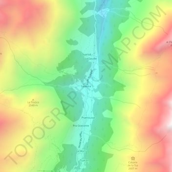
Name: Satarma topographic map, elevation, terrain.
Location: Satarma, Evolène, Hérens, Valais, 1983, Suisse (46.02718 7.46813 46.06718 7.50813)
Average elevation: 2,350 m
Minimum elevation: 1,674 m
Maximum elevation: 3,215 m