
Thank you for supporting this site ❤️
Make a donation
Make a donation
Croker topographic map
Click on the map to display elevation.
Thank you for supporting this site ❤️
Make a donation
Make a donation
About this map
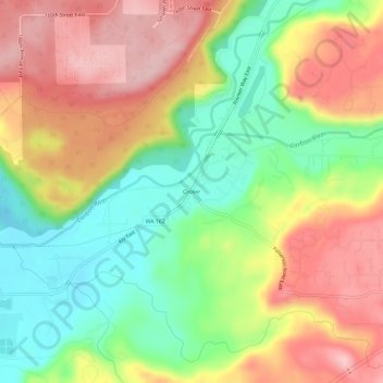
Name: Croker topographic map, elevation, terrain.
Location: Croker, Pierce County, Washington, 98391, United States (47.07260 -122.17678 47.11260 -122.13678)
Average elevation: 158 m
Minimum elevation: 60 m
Maximum elevation: 259 m
Thank you for supporting this site ❤️
Make a donation
Make a donation
Other topographic maps
Click on a map to view its topography, its elevation and its terrain.