
Magallanes topographic map
Interactive map
Click on the map to display elevation.
About this map
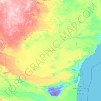
Name: Magallanes topographic map, elevation, terrain.
Location: Magallanes, Santa Cruz Province, Argentina (-49.45514 -69.75736 -48.09140 -66.86934)
Average elevation: 244 m
Minimum elevation: -109 m
Maximum elevation: 1,059 m
Other topographic maps
Click on a map to view its topography, its elevation and its terrain.
Mesa
Argentina > Santa Cruz Province
Mesa, Lago Buenos Aires, Santa Cruz Province, Argentina
Average elevation: 475 m
Perito Moreno
Argentina > Santa Cruz Province
Perito Moreno, Lago Buenos Aires, Santa Cruz Province, Argentina
Average elevation: 407 m