
Trujillo topographic map
Interactive map
Click on the map to display elevation.
About this map
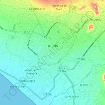
Name: Trujillo topographic map, elevation, terrain.
Location: Trujillo, La Libertad, Pérou (-8.15126 -79.06499 -8.08316 -78.98277)
Average elevation: 37 m
Minimum elevation: 0 m
Maximum elevation: 161 m
Other topographic maps
Click on a map to view its topography, its elevation and its terrain.
M
Pérou > La Libertad > Víctor Larco Herrera
M, San Andres 5ta Etapa, Vista Alegre, Víctor Larco Herrera, Trujillo, La Libertad, Pérou
Average elevation: 10 m