
Weseke topographic map
Interactive map
Click on the map to display elevation.
About this map
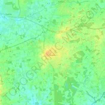
Name: Weseke topographic map, elevation, terrain.
Location: Weseke, Borken, Kreis Borken, Noordrijn-Westfalen, Duitsland (51.88793 6.79482 51.93287 6.90919)
Average elevation: 53 m
Minimum elevation: 43 m
Maximum elevation: 66 m
Weseke ligt nabij de Nederlandse grens, ter hoogte van Winterswijk. Het ligt in het westelijk deel van Münsterland, in een voornamelijk agrarische omgeving.
Other topographic maps
Click on a map to view its topography, its elevation and its terrain.
Burlo
Duitsland > Noordrijn-Westfalen > Kreis Borken > Borken
Burlo, Borken, Kreis Borken, Noordrijn-Westfalen, Duitsland
Average elevation: 51 m