
Burlo topographic map
Interactive map
Click on the map to display elevation.
About this map
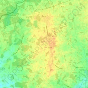
Name: Burlo topographic map, elevation, terrain.
Location: Burlo, Borken, Kreis Borken, Noordrijn-Westfalen, Duitsland (51.85347 6.74313 51.91400 6.84765)
Average elevation: 51 m
Minimum elevation: 35 m
Maximum elevation: 62 m
Other topographic maps
Click on a map to view its topography, its elevation and its terrain.
Weseke
Duitsland > Noordrijn-Westfalen > Kreis Borken > Borken
Weseke, Borken, Kreis Borken, Noordrijn-Westfalen, Duitsland
Average elevation: 53 m