
Huise topographic map
Interactive map
Click on the map to display elevation.
About this map
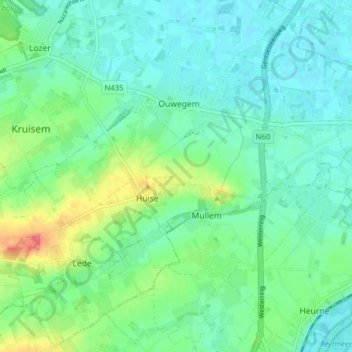
Name: Huise topographic map, elevation, terrain.
Location: Huise, Kruisem, Ostflandern, Flandern, 9750, Belgien (50.88237 3.56368 50.92146 3.64182)
Average elevation: 21 m
Minimum elevation: 5 m
Maximum elevation: 66 m
Other topographic maps
Click on a map to view its topography, its elevation and its terrain.