
San Agustin topographic map
Interactive map
Click on the map to display elevation.
About this map
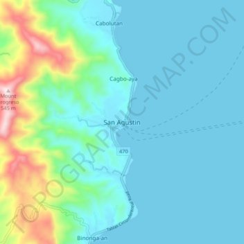
Name: San Agustin topographic map, elevation, terrain.
Location: San Agustin, San Augustin, Romblon, Mimaropa, Philippines (12.52827 122.09397 12.60827 122.17397)
Average elevation: 109 m
Minimum elevation: 0 m
Maximum elevation: 635 m
Other topographic maps
Click on a map to view its topography, its elevation and its terrain.