
Thank you for supporting this site ❤️
Make a donation
Make a donation
Bañadero River topographic map
Click on the map to display elevation.
Thank you for supporting this site ❤️
Make a donation
Make a donation
About this map
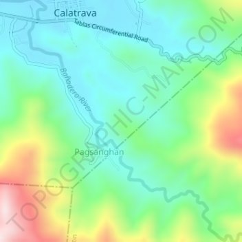
Name: Bañadero River topographic map, elevation, terrain.
Location: Bañadero River, San Agustin, Romblon, Mimaropa, Philippines (12.58953 122.06467 12.62057 122.09613)
Average elevation: 133 m
Minimum elevation: -1 m
Maximum elevation: 446 m
Thank you for supporting this site ❤️
Make a donation
Make a donation
Other topographic maps
Click on a map to view its topography, its elevation and its terrain.