
Lower Austria topographic map
Click on the map to display elevation.
About this map
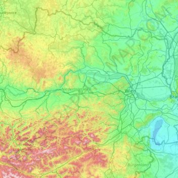
Name: Lower Austria topographic map, elevation, terrain.
Location: Lower Austria, Austria (47.42221 14.45264 49.02052 17.06884)
Average elevation: 498 m
Minimum elevation: 110 m
Maximum elevation: 2,380 m
Other topographic maps
Click on a map to view its topography, its elevation and its terrain.
Zöbing an der Raab
Austria > Styria > Bezirk Weiz > St. Margarethen an der Raab
Average elevation: 352 m