
Thank you for supporting this site ❤️
Make a donation
Make a donation
Lomas de Iguanil topographic map
Click on the map to display elevation.
Thank you for supporting this site ❤️
Make a donation
Make a donation
About this map
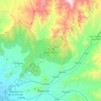
Name: Lomas de Iguanil topographic map, elevation, terrain.
Location: Lomas de Iguanil, Huaral, Lima, Perú (-11.45432 -77.26529 -11.36295 -77.09551)
Average elevation: 665 m
Minimum elevation: 166 m
Maximum elevation: 1,808 m
Thank you for supporting this site ❤️
Make a donation
Make a donation
Other topographic maps
Click on a map to view its topography, its elevation and its terrain.
Thank you for supporting this site ❤️
Make a donation
Make a donation
Thank you for supporting this site ❤️
Make a donation
Make a donation