
Thank you for supporting this site ❤️
Make a donation
Make a donation
San Martín de Retes topographic map
Click on the map to display elevation.
Thank you for supporting this site ❤️
Make a donation
Make a donation
About this map
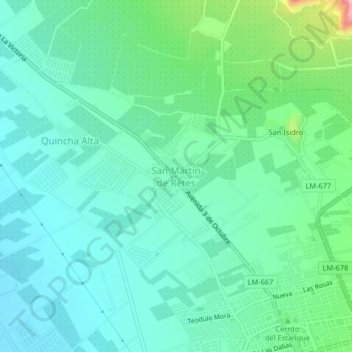
Name: San Martín de Retes topographic map, elevation, terrain.
Location: San Martín de Retes, Huaral, Lima, Perú (-11.49334 -77.24497 -11.45334 -77.20497)
Average elevation: 166 m
Minimum elevation: 124 m
Maximum elevation: 311 m
Thank you for supporting this site ❤️
Make a donation
Make a donation
Other topographic maps
Click on a map to view its topography, its elevation and its terrain.