
Thank you for supporting this site ❤️
Make a donation
Make a donation
Meadow Lane topographic map
Click on the map to display elevation.
Thank you for supporting this site ❤️
Make a donation
Make a donation
About this map
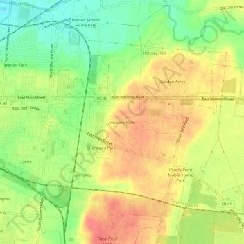
Name: Meadow Lane topographic map, elevation, terrain.
Location: Meadow Lane, Clark County, Ohio, 45505, United States (39.89923 -83.77409 39.93923 -83.73409)
Average elevation: 317 m
Minimum elevation: 283 m
Maximum elevation: 346 m
Thank you for supporting this site ❤️
Make a donation
Make a donation
Other topographic maps
Click on a map to view its topography, its elevation and its terrain.