
Thank you for supporting this site ❤️
Make a donation
Make a donation
Araçariguama topographic map
Click on the map to display elevation.
Thank you for supporting this site ❤️
Make a donation
Make a donation
Araçariguama
Araçariguama is a city on the state of São Paulo in Brazil. It is part of the Metropolitan Region of Sorocaba. The population of city is of 22,860 (2020 est.) in an area of 145.20 km². The elevation is 695 m. Araçariguama was established in 1653.
Thank you for supporting this site ❤️
Make a donation
Make a donation
About this map
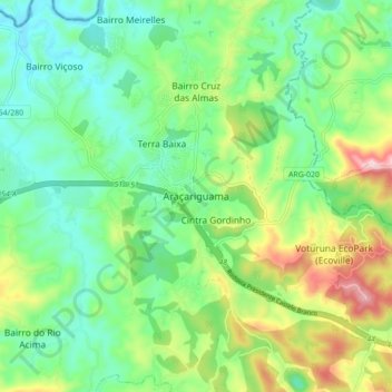
Name: Araçariguama topographic map, elevation, terrain.
Average elevation: 740 m
Minimum elevation: 616 m
Maximum elevation: 1,010 m
Thank you for supporting this site ❤️
Make a donation
Make a donation