

Brazil topographic maps
Click on a map to view its topography, its elevation and its terrain.
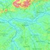
São Paulo
Brazil > São Paulo > Região Metropolitana de São Paulo
The city is on a plateau placed beyond the Serra do Mar (Portuguese for "Sea Range" or "Coastal Range"), itself a component of the vast region known as the Brazilian Highlands, with an average elevation of around 799 meters (2,621 ft) above sea level, although being at a distance of only about 70 kilometers…
Average elevation: 785 m

Barra da Tijuca
Brazil > Rio de Janeiro > Região Metropolitana do Rio de Janeiro > Rio de Janeiro
Average elevation: 4 m

União da Vitória
After that, European immigrants, such as Ukrainians, Poles, Germans and Italians settled with their families in the region, attracted mainly by the similar climate, topography, vegetation and opportunity of having a better quality of life.
Average elevation: 903 m




Recreio dos Bandeirantes
Brazil > Rio de Janeiro > Região Metropolitana do Rio de Janeiro > Rio de Janeiro
Average elevation: 49 m


Goiânia
The "cerrado" landscape is characterized by extensive savanna formations crossed by gallery forests and stream valleys and includes various types of vegetation. Humid fields and "buriti" palm paths are found where the water table is near the surface. Alpine pastures occur at higher altitudes and mesophytic…
Average elevation: 795 m

Manilha
Brazil > Rio de Janeiro > Região Metropolitana do Rio de Janeiro > Itaboraí
Average elevation: 31 m


Rio Branco
Rio Branco is located at 9° 58' 29" south and 67° 48' 36" west, at an altitude of 143 metres (469 ft) above sea level. The city has developed on both sides of the Acre River, with areas known as the First (left bank) and Second Districts. The river is crossed by six bridges, the newest bridge being the…
Average elevation: 176 m

Copacabana
Brazil > Rio de Janeiro > Região Metropolitana do Rio de Janeiro > Rio de Janeiro
Average elevation: 41 m

Monte Carmelo
The municipal seat is located at an elevation of 864 meters. The highest point in the municipality is Cabeceira Córrego Rancharia at 1,343 meters, while the lowest point is Foz Córrego Francos at 724 meters.
Average elevation: 868 m


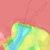
Itaipu Dam
Brazil > Paraná > Foz do Iguaçu
325 metres (1,066 ft), entire dam including the 100 metres (330 ft) high Power Line 4 Pylons atop the Barrage 260 metres (850 ft), dam + the foundation inside water until the river floor 247 metres (810 ft), 196 metres (643 ft) high of roof reinforcement concrete dam + Cranes atop the Barrage 225 metres (738…
Average elevation: 192 m

Rio Grande
Brazil > Rio Grande do Sul > Aglomeração Urbana do Sul
Rio Grande, as the name suggests, is a littoral city, which boasts what many call the longest beach in the world — Praia do Cassino. This beach is approximately 250 km (160 mi) of uninterrupted Atlantic coastline. The entire municipality lies at a very low altitude — at its highest point only 10 meters (33…
Average elevation: 3 m


Armação dos Búzios
Brazil > Rio de Janeiro > Armação dos Búzios > Armação dos Búzios
Average elevation: 5 m


Caldas Novas
The most important study about the thermal ism of Caldas Novas and the Rio Quente was carried out by the state enterprise Furnas Centrais Elétricas, due to the possible influence of the Usina Hidrelétrica Corumbá I dam on the thermal water table of the region, which would be under the risk of cooling.…
Average elevation: 694 m


Lago Azul
Brazil > Goiás > Região Integrada de Desenvolvimento do Distrito Federal e Entorno > Novo Gama
Average elevation: 994 m

Parque Eduardo Guinle
Brazil > Rio de Janeiro > Região Metropolitana do Rio de Janeiro > Rio de Janeiro
Average elevation: 52 m

São Caetano do Sul
Brazil > São Paulo > São Caetano do Sul
São Caetano do Sul is located on a plateau that is part of the Serra do Mar (Portuguese for "Sea Range"), part of the vast region known as the Brazilian Highlands, with an average elevation of around 800 meters (2,600 ft) above sea level – though at a distance of only about 70 kilometers (43 mi) from the…
Average elevation: 759 m


São Carlos
Its altitude is over 856 m. Most of the year the city is windy and sunny, with hot temperatures during all the year.
Average elevation: 775 m


Itu
Brazil > São Paulo > Região Metropolitana de Sorocaba
Itu is a historic municipality in the state of São Paulo in Brazil. It is part of the Metropolitan Region of Sorocaba. The population was 175,568 as of 2020, in an area of 640.72 km2. The elevation is 583 m. This place name comes from the Tupi language, meaning big waterfall. Two rivers flow through Itu:…
Average elevation: 630 m

Rocinha
Brazil > Rio de Janeiro > Região Metropolitana do Rio de Janeiro > Rio de Janeiro
Average elevation: 161 m


Região Norte
Brazil > Rio de Janeiro > Região Metropolitana do Rio de Janeiro > Niterói
Average elevation: 54 m


Águas Lindas de Goiás
Brazil > Goiás > Região Integrada de Desenvolvimento do Distrito Federal e Entorno
Average elevation: 1,063 m


Núcleo Bandeirante
Brazil > Federal District > Região Integrada de Desenvolvimento do Distrito Federal e Entorno
Núcleo Bandeirante is located in the Brazilian Highlands, at an altitude of 1,000 metres (3,300 ft).
Average elevation: 1,045 m


Santo Antônio do Pinhal
Brazil > São Paulo > Região Metropolitana do Vale do Paraíba e Litoral Norte
Santo Antônio do Pinhal is a municipality in the state of São Paulo in Brazil. It is part of the Metropolitan Region of Vale do Paraíba e Litoral Norte. The population is 6,827 (2020 est.) in an area of 133.01 km². The elevation is 1,080 m (3543 ft). It is situated near Campos do Jordão, some 150 km away…
Average elevation: 1,126 m
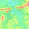
Brumadinho
Brazil > Minas Gerais > Região Metropolitana de Belo Horizonte
Brumadinho (Brazilian Portuguese: [bɾumaˈdʒiɲu]) is a Brazilian municipality in the state of Minas Gerais. The city belongs to the Belo Horizonte metropolitan mesoregion and to the microregion of Belo Horizonte. Brumadinho is at an altitude of 880 m. In 2020 the population was 40,666. The municipality is…
Average elevation: 889 m


Planaltina
Brazil > Federal District > Região Integrada de Desenvolvimento do Distrito Federal e Entorno
Average elevation: 1,010 m


Cássia dos Coqueiros
Brazil > São Paulo > Região Metropolitana de Ribeirão Preto
Cássia dos Coqueiros is a municipality in the state of São Paulo in Brazil. The population is 2,505 (2020 est.) in an area of 192 km². The elevation is 890 m.
Average elevation: 908 m


Taguatinga
Brazil > Federal District > Região Integrada de Desenvolvimento do Distrito Federal e Entorno
Average elevation: 1,181 m

Pelotas
Brazil > Rio Grande do Sul > Aglomeração Urbana do Sul > Pelotas
As it is situated on a plain near the ocean, the urban area lies on a low elevation, being, on average, 7 meters (23 ft) above sea level. The interior of the municipality is on a plateau called Serras de Sudeste (Southeastern Mountain Ranges). Consequently, the altitude in Pelotas' rural area reaches 429…
Average elevation: 18 m

Morro do Pinto
Brazil > Rio de Janeiro > Região Metropolitana do Rio de Janeiro > Rio de Janeiro
Average elevation: 11 m


Rio Paranaíba
The urban center is located at an elevation of 1,040 meters southeast of Patos de Minas in the Rio Borrachudo valley. Neighboring municipalities are: Carmo do Paranaíba and Arapuá (N), São Gotardo and Matutina (E), Araxá and Campos Altos (S), and Serra do Salitre (W).
Average elevation: 1,015 m


Patrocínio
Patrocínio is a municipality in the state of Minas Gerais in Brazil. The population is 91,449 (2020 est.) in an area of 2874 km2. The elevation is 965 m.
Average elevation: 944 m


Rio Branco do Sul
Brazil > Paraná > Região Metropolitana de Curitiba > Rio Branco do Sul > Rio Branco do Sul
Average elevation: 966 m


Bananal
Brazil > São Paulo > Região Metropolitana do Vale do Paraíba e Litoral Norte
Average elevation: 803 m


Cotia
Brazil > São Paulo > Região Metropolitana de São Paulo
Cotia is a municipality in the state of São Paulo in Brazil. It is part of the Metropolitan Region of São Paulo. The population is 253,608 (2020 est.) in an area of 323.99 km2. The city is at an elevation of 853 m. Cotia is linked with the Rodovia Raposo Tavares highway.
Average elevation: 859 m


Coqueiro Seco
The history account that some years later came to the region several missionaries of the order of Franciscans, which delighted up with the topography of the place, which had plans ups and downs, changing its name to Monte Santo. Get accustomed with the old name of the city, the people ignored the Franciscans…
Average elevation: 37 m

