
Bassoues topographic map
Interactive map
Click on the map to display elevation.
About this map
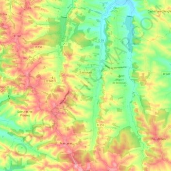
Name: Bassoues topographic map, elevation, terrain.
Average elevation: 220 m
Minimum elevation: 152 m
Maximum elevation: 290 m
Other topographic maps
Click on a map to view its topography, its elevation and its terrain.
Villecomtal-sur-Arros
Villecomtal-sur-Arros, Mirande, Gers, Occitanie, France métropolitaine, 32730, France
Average elevation: 206 m
Au Thuillie
France > Occitanie > Gers > Cazaubon
Au Thuillie, Sentou, Cazaubon, Condom, Gers, Occitanie, France métropolitaine, 32150, France
Average elevation: 121 m