
Unterlangbath topographic map
Interactive map
Click on the map to display elevation.
About this map
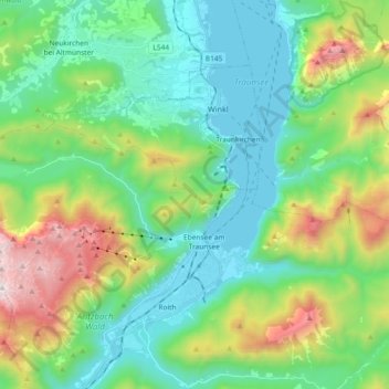
Name: Unterlangbath topographic map, elevation, terrain.
Average elevation: 808 m
Minimum elevation: 417 m
Maximum elevation: 1,851 m
Other topographic maps
Click on a map to view its topography, its elevation and its terrain.
Rotwand
Österreich > Bezirk Gmunden > Ebensee am Traunsee
Rotwand, Ebensee am Traunsee, Bezirk Gmunden, 4802, Österreich
Average elevation: 1,166 m