
Rotwand topographic map
Interactive map
Click on the map to display elevation.
About this map
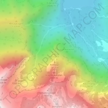
Name: Rotwand topographic map, elevation, terrain.
Location: Rotwand, Ebensee am Traunsee, Bezirk Gmunden, 4802, Österreich (47.73892 13.82943 47.73902 13.82953)
Average elevation: 1,166 m
Minimum elevation: 643 m
Maximum elevation: 1,857 m
Other topographic maps
Click on a map to view its topography, its elevation and its terrain.
Unterlangbath
Österreich > Bezirk Gmunden > Ebensee am Traunsee
Unterlangbath, Ebensee am Traunsee, Bezirk Gmunden, 4802, Österreich
Average elevation: 808 m