
Thank you for supporting this site ❤️
Make a donation
Make a donation
Leon topographic map
Click on the map to display elevation.
Thank you for supporting this site ❤️
Make a donation
Make a donation
About this map
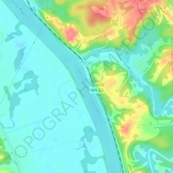
Name: Leon topographic map, elevation, terrain.
Location: Leon, Mason County, West Virginia, United States (38.74117 -81.96290 38.75265 -81.94745)
Average elevation: 184 m
Minimum elevation: 164 m
Maximum elevation: 237 m
Thank you for supporting this site ❤️
Make a donation
Make a donation
Other topographic maps
Click on a map to view its topography, its elevation and its terrain.