
Thank you for supporting this site ❤️
Make a donation
Make a donation
Mercers Bottom topographic map
Click on the map to display elevation.
Thank you for supporting this site ❤️
Make a donation
Make a donation
About this map
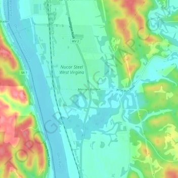
Name: Mercers Bottom topographic map, elevation, terrain.
Location: Mercers Bottom, Mason County, West Virginia, United States (38.62481 -82.18237 38.66481 -82.14237)
Average elevation: 189 m
Minimum elevation: 157 m
Maximum elevation: 264 m
Thank you for supporting this site ❤️
Make a donation
Make a donation
Other topographic maps
Click on a map to view its topography, its elevation and its terrain.