
Pointe Parrot topographic map
Interactive map
Click on the map to display elevation.
About this map
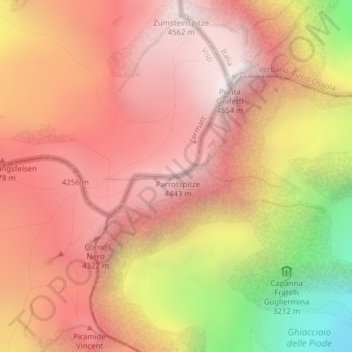
Name: Pointe Parrot topographic map, elevation, terrain.
Location: Pointe Parrot, Zermatt, Viège, Valais, 3920, Suisse (45.91970 7.87083 45.91980 7.87093)
Average elevation: 3,887 m
Minimum elevation: 2,670 m
Maximum elevation: 4,551 m
Other topographic maps
Click on a map to view its topography, its elevation and its terrain.
Pointe Dufour (Mont Rose)
Pointe Dufour (Mont Rose), Zermatt, Viège, Valais, 3920, Suisse
Average elevation: 4,033 m
Gornergrat
Gornergrat, Hohtälli, Ze Seewjinen, Zermatt, Viège, Valais, 3920, Suisse
Average elevation: 2,768 m
Gabelhorngletscher
Gabelhorngletscher, Arbenbiwak, Chalbermatten, Zermatt, Viège, Valais, 3920, Suisse
Average elevation: 3,134 m