
Thank you for supporting this site ❤️
Make a donation
Make a donation
Whitehouse topographic map
Click on the map to display elevation.
Thank you for supporting this site ❤️
Make a donation
Make a donation
About this map
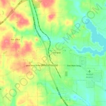
Name: Whitehouse topographic map, elevation, terrain.
Location: Whitehouse, Smith County, Texas, 75791, United States (32.20141 -95.25077 32.26751 -95.18731)
Average elevation: 141 m
Minimum elevation: 110 m
Maximum elevation: 185 m
Thank you for supporting this site ❤️
Make a donation
Make a donation
Other topographic maps
Click on a map to view its topography, its elevation and its terrain.
Thank you for supporting this site ❤️
Make a donation
Make a donation
Thank you for supporting this site ❤️
Make a donation
Make a donation