
Giswil topographic map
Interactive map
Click on the map to display elevation.
About this map
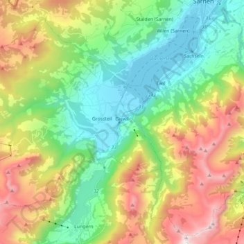
Name: Giswil topographic map, elevation, terrain.
Location: Giswil, Obwald, 6074, Suisse (46.78594 8.04220 46.88704 8.21599)
Average elevation: 1,136 m
Minimum elevation: 467 m
Maximum elevation: 2,322 m
Other topographic maps
Click on a map to view its topography, its elevation and its terrain.