
Sarnen topographic map
Interactive map
Click on the map to display elevation.
About this map
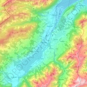
Name: Sarnen topographic map, elevation, terrain.
Location: Sarnen, Obwald, Suisse (46.85422 8.06700 46.93346 8.27766)
Average elevation: 1,040 m
Minimum elevation: 428 m
Maximum elevation: 2,354 m
Other topographic maps
Click on a map to view its topography, its elevation and its terrain.