
Faridpur topographic map
Interactive map
Click on the map to display elevation.
About this map
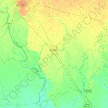
Name: Faridpur topographic map, elevation, terrain.
Location: Faridpur, Distrikt Bareilly, Uttar Pradesh, Indien (28.01554 79.38613 28.37241 79.74242)
Average elevation: 164 m
Minimum elevation: 152 m
Maximum elevation: 179 m
Other topographic maps
Click on a map to view its topography, its elevation and its terrain.
Palia
Indien > Uttar Pradesh > Palia
Palia, Kheri, Uttar Pradesh, 262902, Indien
Average elevation: 157 m
Chandan Chowky
Indien > Uttar Pradesh > Chandan Chowky
Chandan Chowky, Kheri, Uttar Pradesh, Indien
Average elevation: 159 m
Yamuna
Yamuna, Firozabad, Uttar Pradesh, 282004, Indien
Average elevation: 707 m