
Perry County topographic map
Interactive map
Click on the map to display elevation.
About this map
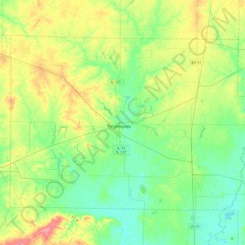
Name: Perry County topographic map, elevation, terrain.
Location: Perry County, Illinois, États-Unis (37.95139 -89.59582 38.22035 -89.11852)
Average elevation: 143 m
Minimum elevation: 112 m
Maximum elevation: 211 m
Other topographic maps
Click on a map to view its topography, its elevation and its terrain.
Basco
États-Unis > Illinois > Basco
Basco, Hancock County, Illinois, États-Unis
Average elevation: 194 m
Golf
États-Unis > Illinois > Golf
Golf, Cook County, Illinois, 60029, États-Unis
Average elevation: 195 m