

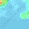
Valras-Plage topographic map
Click on the map to display elevation.
Valras-Plage
L'altitude de la commune varie entre 0, au niveau de la mer, et 10 mètres.
About this map

Name: Valras-Plage topographic map, elevation, terrain.
Average elevation: 4 m
Minimum elevation: -2 m
Maximum elevation: 21 m
Other topographic maps
Click on a map to view its topography, its elevation and its terrain.

































La Trivalle
France > Occitanie > Hérault > La Vacquerie-et-Saint-Martin-de-Castries
Average elevation: 667 m



Chalet de La Vacquerie
France > Occitanie > Hérault > La Vacquerie-et-Saint-Martin-de-Castries
Average elevation: 670 m


