
Thank you for supporting this site ❤️
Make a donation
Make a donation
Granbury topographic map
Click on the map to display elevation.
Thank you for supporting this site ❤️
Make a donation
Make a donation
About this map
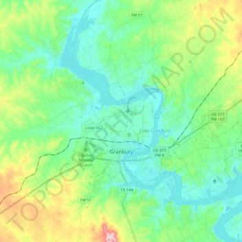
Name: Granbury topographic map, elevation, terrain.
Location: Granbury, Hood County, Texas, 76048, United States (32.41132 -97.83436 32.49073 -97.68193)
Average elevation: 242 m
Minimum elevation: 210 m
Maximum elevation: 368 m
Thank you for supporting this site ❤️
Make a donation
Make a donation
Other topographic maps
Click on a map to view its topography, its elevation and its terrain.