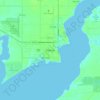
Bay City topographic map
Click on the map to display elevation.
Bay City
Bay City Regional Airport covers an area of 141 acres (57 ha) at an elevation of 45 feet (14 m) above mean sea level. It has one runway designated 13/31 with a 5,107 by 75 ft (1,557 x 23 m) asphalt surface.
About this map

Name: Bay City topographic map, elevation, terrain.
Location: Bay City, Matagorda County, Texas, United States (28.94579 -96.00006 29.02026 -95.89052)
Average elevation: 16 m
Minimum elevation: 6 m
Maximum elevation: 21 m
Other topographic maps
Click on a map to view its topography, its elevation and its terrain.