
Nouvelle-France topographic map
Interactive map
Click on the map to display elevation.
About this map
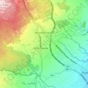
Name: Nouvelle-France topographic map, elevation, terrain.
Location: Nouvelle-France, Grand Port, Maurice (-20.40974 57.51953 -20.35574 57.58660)
Average elevation: 420 m
Minimum elevation: 269 m
Maximum elevation: 681 m
Other topographic maps
Click on a map to view its topography, its elevation and its terrain.