
Thank you for supporting this site ❤️
Make a donation
Make a donation
Palm Shores topographic map
Click on the map to display elevation.
Thank you for supporting this site ❤️
Make a donation
Make a donation
About this map
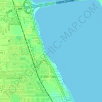
Name: Palm Shores topographic map, elevation, terrain.
Location: Palm Shores, Brevard County, Florida, United States (28.17760 -80.67623 28.20676 -80.64986)
Average elevation: 5 m
Minimum elevation: -2 m
Maximum elevation: 13 m
Thank you for supporting this site ❤️
Make a donation
Make a donation
Other topographic maps
Click on a map to view its topography, its elevation and its terrain.
Thank you for supporting this site ❤️
Make a donation
Make a donation
Thank you for supporting this site ❤️
Make a donation
Make a donation