
San Antonio de Capayacuar topographic map
Interactive map
Click on the map to display elevation.
About this map
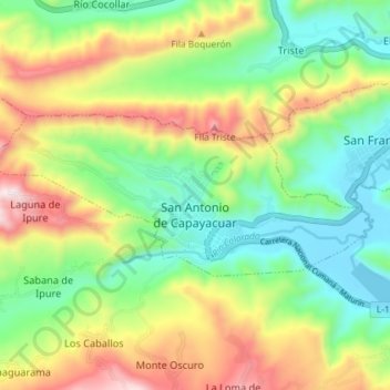
Name: San Antonio de Capayacuar topographic map, elevation, terrain.
Average elevation: 708 m
Minimum elevation: 427 m
Maximum elevation: 1,165 m
Other topographic maps
Click on a map to view its topography, its elevation and its terrain.
Municipio Acosta
Venezuela > Estado Monagas > Municipio Acosta
Municipio Acosta, Estado Monagas, Venezuela
Average elevation: 824 m