
Mufumbwe topographic map
Interactive map
Click on the map to display elevation.
About this map
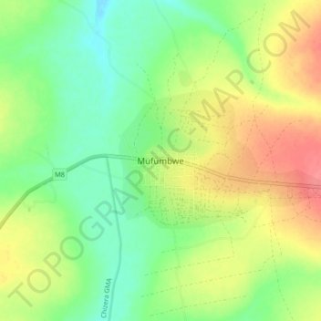
Name: Mufumbwe topographic map, elevation, terrain.
Location: Mufumbwe, Mufumbwe District, North-Western Province, Zambia (-13.17727 24.96565 -13.09727 25.04565)
Average elevation: 1,164 m
Minimum elevation: 1,137 m
Maximum elevation: 1,200 m
Other topographic maps
Click on a map to view its topography, its elevation and its terrain.
Lumwana
Zambia > North-Western Province
Lumwana, Kalumbila District, North-Western Province, Zambia
Average elevation: 1,376 m
Kalumbila District
Zambia > North-Western Province
Kalumbila District, North-Western Province, Zambia
Average elevation: 1,312 m
Mufumbwe District
Zambia > North-Western Province
Mufumbwe District, North-Western Province, Zambia
Average elevation: 1,172 m