
Thank you for supporting this site ❤️
Make a donation
Make a donation
Irchonwelz topographic map
Click on the map to display elevation.
Thank you for supporting this site ❤️
Make a donation
Make a donation
About this map
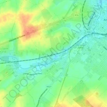
Name: Irchonwelz topographic map, elevation, terrain.
Location: Irchonwelz, Ath, Hainaut, Wallonie, 7801, Belgique (50.60665 3.73828 50.63672 3.77009)
Average elevation: 46 m
Minimum elevation: 28 m
Maximum elevation: 73 m
Thank you for supporting this site ❤️
Make a donation
Make a donation
Other topographic maps
Click on a map to view its topography, its elevation and its terrain.