
Thank you for supporting this site ❤️
Make a donation
Make a donation
Grendel topographic map
Click on the map to display elevation.
Thank you for supporting this site ❤️
Make a donation
Make a donation
About this map
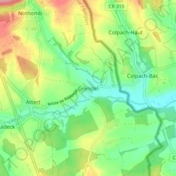
Name: Grendel topographic map, elevation, terrain.
Location: Grendel, Attert, Arlon, Luxembourg, Wallonie, 6717, Belgique (49.73464 5.78660 49.77464 5.82660)
Average elevation: 320 m
Minimum elevation: 276 m
Maximum elevation: 392 m
Thank you for supporting this site ❤️
Make a donation
Make a donation
Other topographic maps
Click on a map to view its topography, its elevation and its terrain.