
Surnadal topographic map
Interactive map
Click on the map to display elevation.
About this map
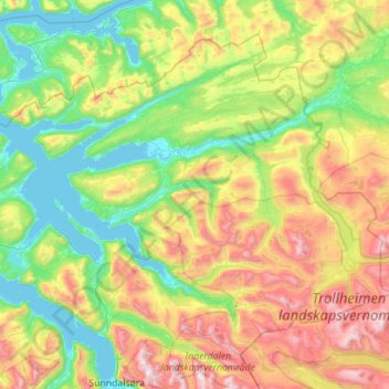
Name: Surnadal topographic map, elevation, terrain.
Location: Surnadal, Møre og Romsdal, Norway (62.71177 8.24371 63.13392 9.36483)
Average elevation: 522 m
Minimum elevation: -1 m
Maximum elevation: 1,808 m
Other topographic maps
Click on a map to view its topography, its elevation and its terrain.
Norddal
Norddal, Fjord, Møre og Romsdal, 6214, Norway
Average elevation: 364 m