
Gjøvik topographic map
Interactive map
Click on the map to display elevation.
About this map
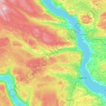
Name: Gjøvik topographic map, elevation, terrain.
Location: Gjøvik, Innlandet, Norway (60.70747 10.16766 61.03683 10.74476)
Average elevation: 422 m
Minimum elevation: 120 m
Maximum elevation: 942 m
Other topographic maps
Click on a map to view its topography, its elevation and its terrain.
Li
Norway > Innlandet > Skammestein
Li, Skammestein, Øystre Slidre, Innlandet, 2950, Norway
Average elevation: 774 m