
Thank you for supporting this site ❤️
Make a donation
Make a donation
Piepenbrink topographic map
Click on the map to display elevation.
Thank you for supporting this site ❤️
Make a donation
Make a donation
About this map
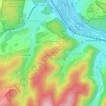
Name: Piepenbrink topographic map, elevation, terrain.
Location: Piepenbrink, Hagen, Noordrijn-Westfalen, 58119, Duitsland (51.34490 7.55537 51.34500 7.55547)
Average elevation: 212 m
Minimum elevation: 113 m
Maximum elevation: 362 m
Thank you for supporting this site ❤️
Make a donation
Make a donation
Other topographic maps
Click on a map to view its topography, its elevation and its terrain.