
Port Neches topographic map
Click on the map to display elevation.
About this map
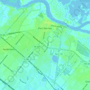
Name: Port Neches topographic map, elevation, terrain.
Location: Port Neches, Jefferson County, Texas, 77651, United States (29.94305 -93.98297 30.01251 -93.89893)
Average elevation: 4 m
Minimum elevation: -3 m
Maximum elevation: 11 m
Other topographic maps
Click on a map to view its topography, its elevation and its terrain.