Germany topographic maps
Click on a map to view its topography, its elevation and its terrain.
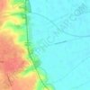
Battle of the Seelow Heights
Germany > Brandenburg > Märkisch-Oderland > Seelow
Average elevation: 22 m
Cochem
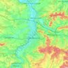
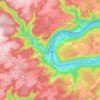
Germany > Rhineland-Palatinate > Landkreis Cochem-Zell
Cochem lies at an elevation of some 83 m above sea level and the municipal area measures 21.2 km2. The town centre with the outlying centre of Sehl upstream lies on the Moselle's left bank, while the constituent centre of Cond lies on its right. A further constituent centre, Brauheck, with its commercial area,…
Average elevation: 286 m
Freising
Germany > Bavaria > Landkreis Freising
In 1802/1803 Bavaria fell under the influence of Napoleonic France in which church controlled lands were secularized. In Freising, the more than thousand-year-old bishopric was abolished. The Roman Catholic Church lost most of its properties and authority over the city. Though the seat of the diocese was moved…
Average elevation: 457 m
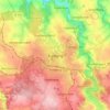
Freiberg
Germany > Saxony > Mittelsachsen
The town lies on the northern declivity of the Ore Mountains, with the majority of the borough west of the Eastern or Freiberger Mulde river. Parts of the town are nestled in the valleys of Münzbach and Goldbach streams. Its centre has an altitude of about 412 m above sea level (NHN) (at the railway station).…
Average elevation: 405 m
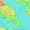
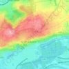
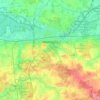
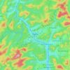
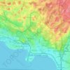
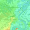
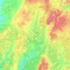
Bernkastel-Kues
Germany > Rhineland-Palatinate > Landkreis Bernkastel-Wittlich
Bernkastel-Kues lies in the Mosel valley, roughly 50 km (31 mi) from Trier. The greatest elevation is the Olymp (415 m above sea level), and the lowest point (107 m above sea level) lies on the Mosel's banks. The municipal area totals 23 657 101 m2, of which 7 815 899 m2 is used for agriculture, thereby making…
Average elevation: 269 m
Bad Krozingen
Germany > Baden-Württemberg > Landkreis Breisgau-Hochschwarzwald
Average elevation: 243 m


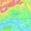
Wiesbaden
The highest point of the Wiesbaden municipality is located northwest of the city center near the summit of the Hohe Wurzel, with an elevation of 608 metres (1,995 ft) above sea level. The lowest point is the harbour entrance of Schierstein at 83 metres (272 ft) above sea level. The central square (the…
Average elevation: 221 m
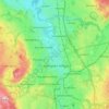
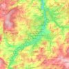
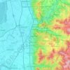
Hohenstein-Ernstthal
Hohenstein-Ernsthal is located about 15 kilometres (9.3 mi) west of Chemnitz. The Ore Mountains rise south of the city. The highest point of Hohenstein-Ernstthal is the Pfaffenberg north of the town with an elevation of 479 metres (1,572 ft).
Average elevation: 369 m
Velbert
Germany > North Rhine-Westphalia > Kreis Mettmann
Velbert stands on the highest part of the Niederberg region and also in its centre. Its average elevation is around 230 metres above sea level; its highest point, at 303 metres, is the Hordt-Berg, and its lowest, at around 70.6 metres, is in Nierenhof am Deilbach. The highest point in Velbert itself is 263…
Average elevation: 172 m
Wetzlar
Germany > Hesse > Lahn-Dill-Kreis
Wetzlar has a year-round temperate seasonal climate of the middle latitudes. Between the different elevations there are different small climatic conditions. The daily mean temperature in summer is about 17 to 18 °C (63 to 64 °F) and in winter about 1 to 2 °C (34 to 36 °F). The average rainfall is 600 to…
Average elevation: 232 m
Schwarzenberg/Erzgebirge
Germany > Saxony > Erzgebirgskreis
Schwarzenberg is in the southwestern Ore Mountains. It lies at elevations stretching from 428.5 to 823 metres (1,406 to 2,700 ft) above sea level. The Old Town with church and castle is located on a rock (the Schlossberg, 593 metres (1,946 ft)) around which a meander of the River Schwarzwasser has formed; the…
Average elevation: 623 m


Siedlinghausen
Germany > North Rhine-Westphalia > Hochsauerlandkreis > Winterberg
Average elevation: 563 m

Erbach
Germany > Hesse > Odenwaldkreis
The town lies in the Mittelgebirge Odenwald at elevations between 200 and 560 m in the valley of the Mümling.
Average elevation: 394 m


Oberwiesenthal
Germany > Saxony > Erzgebirgskreis
Oberwiesenthal lies in the county of Erzgebirgskreis, on the border with the Czech Republic that follows the course of the Pöhlbach stream as far as Bärenstein (10 km northeast). The highest elevation in the borough is the Fichtelberg (sometimes called the Großer Fichtelberg or Great Fichtelberg) which, at…
Average elevation: 928 m



Erfurt
Erfurt is situated in the south of the Thuringian basin, a fertile agricultural area between the Harz mountains 80 km (50 mi) to the north and the Thuringian Forest 30 km (19 mi) to the southwest. Whereas the northern parts of the city area are flat, the southern ones consist of hilly landscape up to 430 m of…
Average elevation: 251 m

Limburg an der Lahn
Germany > Hesse > Landkreis Limburg-Weilburg
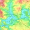
The town lies roughly centrally in a basin within the Rhenish Slate Mountains which is surrounded by the low ranges of the Taunus and Westerwald and called the Limburg Basin (Limburger Becken). Owing to the favourable soil and climate, the Limburg Basin stands as one of Hesse's richest agricultural regions and…
Average elevation: 164 m

Strasburg (Uckermark)
Germany > Mecklenburg-Vorpommern > Vorpommern-Greifswald
Average elevation: 68 m
Idar-Oberstein
Germany > Rhineland-Palatinate > Landkreis Birkenfeld
Idar-Oberstein/Göttschied Airfield lies north of the town between the constituent community of Göttschied and the municipalities of Gerach and Hintertiefenbach at an elevation of 480 m above sea level (1,575 feet). Its ICAO location indicator is EDRG. The grass landing strip's orientation is 06/24, and it is…
Average elevation: 406 m