Geolocate

Thuringia topographic maps

Click on a map to view its topography, its elevation and its terrain.
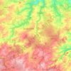
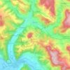
Zeulenroda-Triebes

Germany > Thuringia > Greiz

Average elevation: 421 m

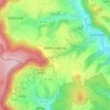
Marbach

Germany > Thuringia > Erfurt

Average elevation: 225 m

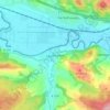
Haynrode

Germany > Thuringia > Landkreis Eichsfeld

Average elevation: 381 m

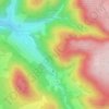
Trebnitz

Germany > Thuringia > Gera

Average elevation: 275 m

98528

Germany > Thuringia > Suhl > Goldlauter

Average elevation: 720 m

Gorma

Germany > Thuringia > Altenburger Land

Average elevation: 196 m

Serba

Germany > Thuringia > Saale-Holzland-Kreis

Average elevation: 302 m

Landkreis Weimarer Land

Germany > Thuringia

The main river in the district is the Ilm. To the south are the hills of the Thuringian Forest, where the highest elevation is the Riechheimer Berg with 511 m above sea level. To the north of the district the landscape becomes less hilly, it belongs to the Thüringer Becken. In this part is also the lowest…

Average elevation: 291 m

Kospoda

Germany > Thuringia > Saale-Orla-Kreis

Average elevation: 388 m

Geismar

Germany > Thuringia > Landkreis Eichsfeld

Average elevation: 292 m

Sonnenstein

Germany > Thuringia > Landkreis Eichsfeld

Average elevation: 295 m

Hirschberg

Germany > Thuringia > Saale-Orla-Kreis > Hirschberg

Average elevation: 547 m

Pfaffschwende

Germany > Thuringia > Landkreis Eichsfeld

Average elevation: 351 m

Lauchröden

Germany > Thuringia > Wartburgkreis

Average elevation: 242 m

Ehrenberg

Germany > Thuringia > Landkreis Hildburghausen

Average elevation: 392 m

Thamsbrück

Germany > Thuringia > Unstrut-Hainich-Kreis > Bad Langensalza

Thamsbrück is located in the west of the Thuringian Basin about 4 kilometres (2.5 mi) north of Bad Langensalza at an altitude of 175 metres (574 ft) above NHN. The surrounding area is agricultural. On the southern and western edge of the village, the Unstrut, with two river courses, flows eastwards to the…

Average elevation: 189 m

About this place

 •  •  •  •  •  •  •  •  •  •  •  •  •  •