
Artemisa topographic map
Interactive map
Click on the map to display elevation.
About this map
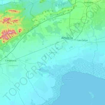
Name: Artemisa topographic map, elevation, terrain.
Location: Artemisa, 33800, Cuba (22.59946 -82.98339 22.93265 -82.65689)
Average elevation: 49 m
Minimum elevation: 0 m
Maximum elevation: 542 m
Other topographic maps
Click on a map to view its topography, its elevation and its terrain.