
Thank you for supporting this site ❤️
Make a donation
Make a donation
Mariel topographic map
Click on the map to display elevation.
Thank you for supporting this site ❤️
Make a donation
Make a donation
About this map
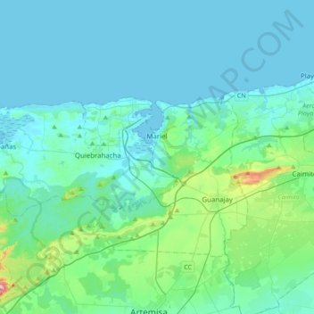
Name: Mariel topographic map, elevation, terrain.
Location: Mariel, Artemisa, Cuba (22.90858 -83.00675 23.02822 -82.66610)
Average elevation: 45 m
Minimum elevation: 0 m
Maximum elevation: 377 m
Thank you for supporting this site ❤️
Make a donation
Make a donation